Trail Touring skiing La Léchère - M'ont Bellacha NE par le col de l'arc - Photo

M'ont Bellacha NE par le col de l'arc

 nadd73
nadd73

User

© OpenStreetMap contributors
Length
Length
14.1 km
Max alt
Max alt
2459 m
Uphill gradient
Uphill gradient
1531 m
Km-Effort
Km-Effort  
35 km
Min alt
Min alt
923 m
Downhill gradient
Downhill gradient
1529 m
Boucle
Boucle
Yes
Creation date :
2022-01-19 08:33:07.498
Updated on :
2022-01-19 17:27:25.645

(0 Reviews)

Touring skiing
Touring skiing
5h32
Difficulty : Difficult

Scan this QR Code to open this trail in the SityTrail application

FREE GPS app for hiking

Logo SityTrail SityTrail

IGN / Geographical institutes

Download SityTrail from the App Store Download SityTrail from Google Play

Logo SityTrail SityTrail World

The world is yours!

Download SityTrail from the App Store Download SityTrail from Google Play Download SityTrail on Huawei AppGallery

About

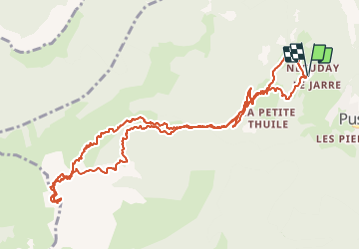
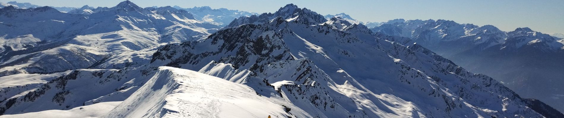
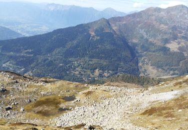
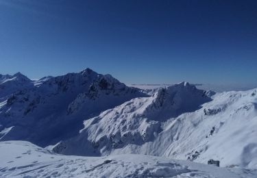
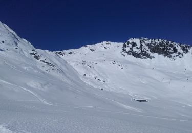
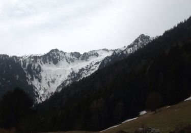
Trail Touring skiing of 14.1 km to be discovered at Auvergne-Rhône-Alpes, Savoy, La Léchère. This trail is proposed by nadd73.
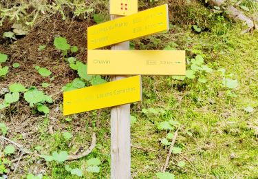
Description

Départ de Necuday.
Je suis montée dans la combe des Charmettes. Mais il parait que c'est plus joli en passant par le col de l'arc et faire l'arête NO
prévoir crampons pour celle ci Sinon descente Idem

Elevation profile

Photos

Positioning

Country:
France
Region :
Auvergne-Rhône-Alpes
Department/Province :
Savoy
Municipality :
La Léchère
Location:
Pussy
Start:(UTM)
300797 ; 5047899 (32T) N.

Trails nearby

Trail Walking La Léchère - les marmottes noires et Bellacha  - Photo
Walking
nadd73

Walking

Medium
La Léchère, Auvergne-Rhône-Alpes, Savoy, France
12.2 km | 27 km-effort
5h 25min
Yes
Trail Walking Cevins - Cevins acte 1 - Photo
Walking
bill73

Walking

Very difficult
Cevins, Auvergne-Rhône-Alpes, Savoy, France
18.3 km | 40 km-effort
5h 7min
Yes
Trail Touring skiing La Léchère - pointe des Arangles - Photo
Touring skiing
nadd73

Touring skiing

Medium
La Léchère, Auvergne-Rhône-Alpes, Savoy, France
12.9 km | 29 km-effort
5h 30min
Yes
Trail Touring skiing Saint-Paul-sur-Isère - la thuile - Photo
Touring skiing
nadd73

Touring skiing

Easy
Saint-Paul-sur-Isère, Auvergne-Rhône-Alpes, Savoy, France
11.4 km | 24 km-effort
5h 42min
Yes
Trail Walking La Léchère - Ronchat La Cudraz Navette Plan des Heures Balcon des Adrets de Tarentaise  - Photo
Walking
zazie

Walking

Difficult
La Léchère, Auvergne-Rhône-Alpes, Savoy, France
8.3 km | 13.7 km-effort
3h 0min
Yes
Trail Walking La Léchère - les pissus  - Photo
Walking
mdurbecq

Walking

Very easy
La Léchère, Auvergne-Rhône-Alpes, Savoy, France
5.2 km | 10.9 km-effort
4h 11min
Yes
Trail Walking La Léchère - Necuday-La Tuile - Photo
Walking
Bogapuki

Walking

Easy
La Léchère, Auvergne-Rhône-Alpes, Savoy, France
10.9 km | 17.3 km-effort
3h 44min
Yes
Trail Mountain bike La Léchère - Feissons sur Isère - pont de le Vieille scie - Photo
Mountain bike
XavierFaidix

Mountain bike

Difficult
La Léchère, Auvergne-Rhône-Alpes, Savoy, France
27 km | 49 km-effort
4h 0min
Yes
Trail Mountain bike La Léchère - pussy les chaux et pussy la mouche - Photo
Mountain bike
XavierFaidix

Mountain bike

Difficult
La Léchère, Auvergne-Rhône-Alpes, Savoy, France
29 km | 53 km-effort
4h 0min
Yes


Close
My subscriptions